Primary Functions
- Learn about current and future risks of riverine and coastal flooding, taking into account the impacts that socioeconomic growth and climate change will have.
Detailed Description
Aqueduct’s tools map water risks such as floods, droughts, and stress, using open-source, peer reviewed data. Beyond the tools, the Aqueduct team works one-on-one with companies, governments, and research partners to help advance best practices in water resources management and enable sustainable growth in a water-constrained world.
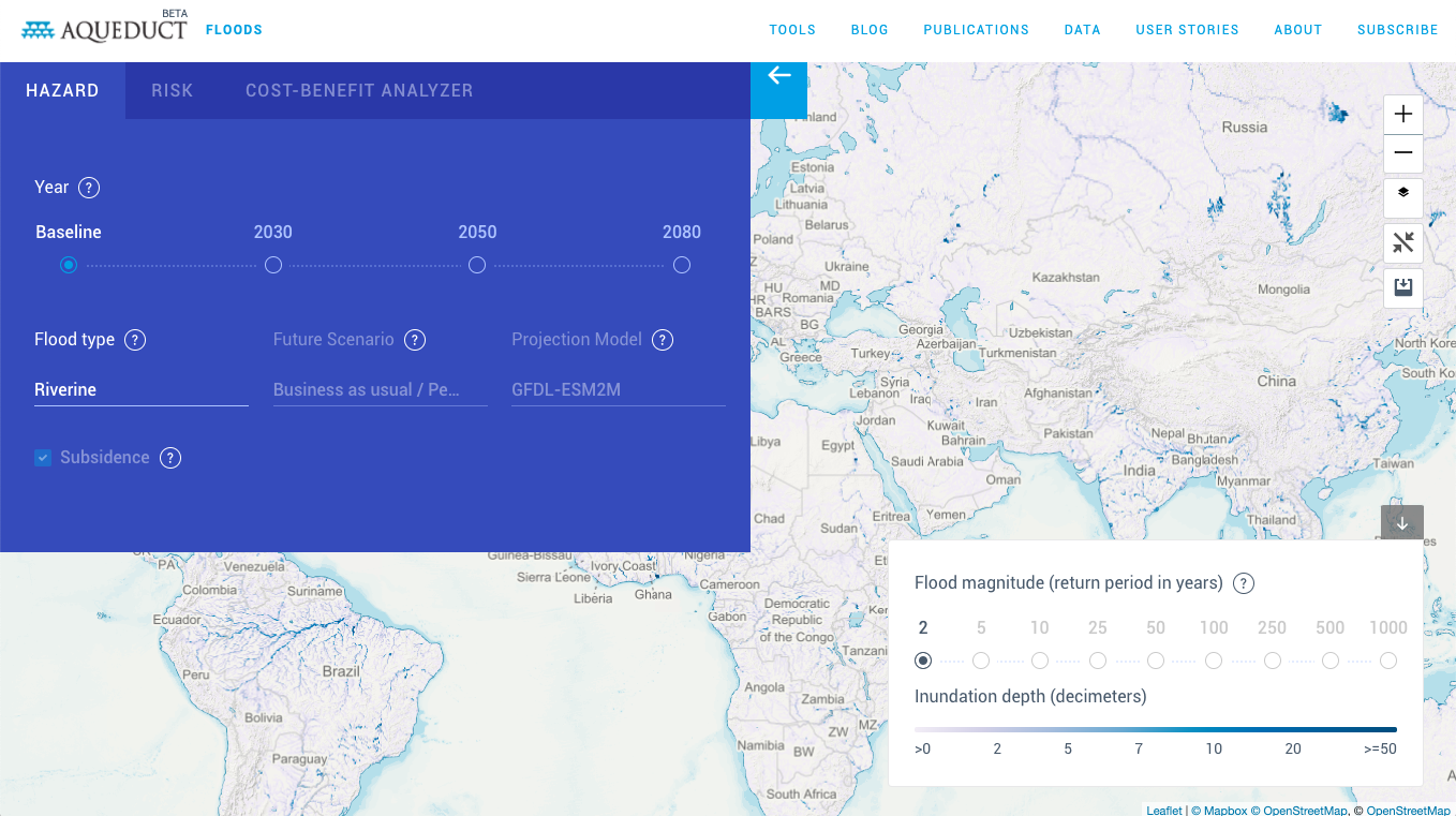
As flooding increases around the world, decision-makers need tools and data to protect communities, target investments, and mitigate future risks. Aqueduct Floods measures and maps water-related flood risks around the world. It evaluates current and future risks of riverine and coastal flooding, taking into account the impacts that socioeconomic growth and climate change will have. Aqueduct Floods also allows users to conduct comprehensive cost-benefit analysis to evaluate the value of dike flood protection strategies.
Aqueduct Floods was created by a consortium of data partners, including WRI, Deltares, Vrije Universiteit Amsterdam’s Institute for Environmental Studies, Utrecht University and Planbureau voor de Leefomgeving (PBL Netherlands Environmental Assessment Agency), with funding support from the Dutch Ministry of Infrastructure and Water Management.