Primary Functions
- Design a basket of strategies for balanced water demand and supply management in the watershed
Detailed Description
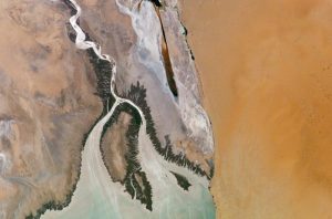
CII-TWI has developed an innovative Water Planning & Assessment Tool (WATSCANTM) which is an integrated IT driven, GIS and Remote Sensing based information system that enables comprehensive watershed evaluation, aimed at devising community-centric water management interventions. It is a robust Tool that enables spatial and temporal analyses using various datasets that include:
• Satellite data on topography
• Satellite data for land-use/cover
• Indian Meteorological Department daily gridded rainfall data
• Digitized soil databases
The Tool derives the outputs based on a strong mathematical interplay of various inputs and parameters.
It can be used for designing a basket of strategies for balanced water demand and supply management in the watershed
• Proper siting of water schemes/ infrastructure for efficient water delivery.
• Evaluating area-wide availability of water, access & demand-supply analysis.
• Developing an improved water scenario and water framework.
• Recommending technological, policy and institutional interventions for improving lives and livelihoods of community over the short, medium and long term.
• Evaluating area-wide availability of water, access & demand-supply analysis.
• Developing an improved water scenario and water framework.
• Recommending technological, policy and institutional interventions for improving lives and livelihoods of community over the short, medium and long term.
Results show that application of WATSCAN can
• Improve water productivity ~20-30% in the short term
• Improve water use efficiency ~ 40-50% with cost effective strategies
• Enhance opportunities to dovetail water-related industry initiatives with Government programs
• Reduce water risks thereby ensuring long-term water sustainability
• Improve water use efficiency ~ 40-50% with cost effective strategies
• Enhance opportunities to dovetail water-related industry initiatives with Government programs
• Reduce water risks thereby ensuring long-term water sustainability
Application Highlights
• On the basis of the discussions had with the Government of India, CII has taken upon itself the Mission of improved water scenario across drought-prone regions with support from its members.
• 50 districts across 10 drought affected/prone states for evaluation have been identified.
• Extensively working in the state of Maharashtra on water management across 13 districts.
• Successfully applied to Udaipur in Rajasthan, Hardoi in Uttar Pradesh, Gurgaon in Haryana, and drought-prone district, Pune in Maharashtra